Here, away from the crowded ski resorts, you can experience the peace and quiet of winter in its purest form. With every step through the fresh snow, with every breath through the clear winter air, you can feel the decelerating effect of winter hiking.</p

Grins - Stanz
From the sports ground in Grins, the route leads past the Kneipp facility and the Gempel chapel along the forest path to Stanz. Return along the same route to the starting point.
Read more
Via Claudia Augusta
Place: Landeck | FließEven in winter, the hiking trail that leads along the 2000-year-old Via Claudia Augusta is a very special experience. With marvellous views, this hike offers lasting impressions.
Read more
Tramser Weiher round
Place: Landeck | ZamsFrom Landeck parish church, the trail leads past Landeck Castle via the Tramsweg to the Tramser Weiher pond. The way back leads along the Tramsweg to Zams and from there along a forest path back to Landeck parish church.
Read more
Tramser Weiher - Kronburg return
Place: Landeck | ZamsThis hike leads from Trams via the Hammerlweg and Rifenal to the pilgrimage site of Kronburg. The return journey follows the same route.
Read more
Grins - Gmar - Grist
Place: GrinsFrom the parish church in Grins, follow the road in the direction of Pians. Climb up to Gmar and Grist and follow the road back to the starting point.
Read more
Tobadill - Castle Wiesberg
Place: TobadillBeautiful hike from the mountain village Tobadill to the castle Wiesberg and the famous Trisanna bridge.
Read more
Gogles Alm in winter 2,017m
Open! Open! Place: FließThe alpine meadows offer a breathtaking backdrop in winter and from the terrace of our alp you have a wonderful view of the surrounding snowy mountain landscape.
Read more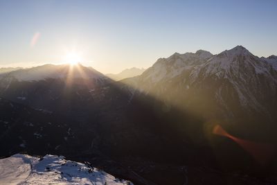
Weg der Aussicht
Place: Zams | FließOn the popular "Weg der Aussicht", you can enjoy the circular path with its breathtaking view at the Venet mountain station.
Read more