E5 Alpin | Krahberg - Glanderspitze - Piller
Place: Zams | Fließ | PillerFrom the mountain station of the Venet cable car on the Krahberg 2,208 m, the tour leads along the Venet circular hiking trail via Glanderspitze 2,505 m), Kreuzjoch 2,464 m and Galflun Alm 1,961 m to Piller.
Read more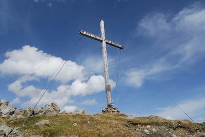
Landeck - Glanderspitze (Erzherzog-Eugen-Weg)
Place: Landeck | FließThe ascent over the so-called Archduke Eugen Weg lets you forget the effort of seeing the unforgettable mountain panorama, with striking peaks such as Wildspitze, Zugspitze, Ortler, Valluga, Riffler, Parseier and many more.
Read more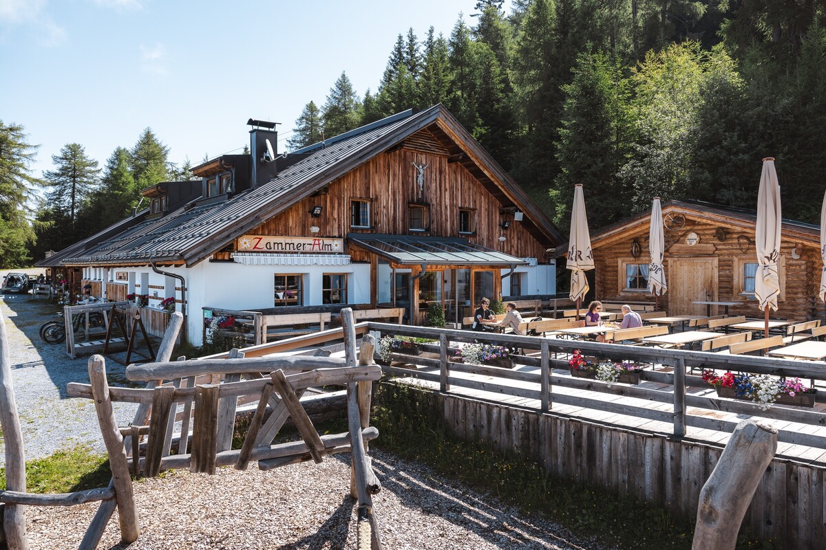
Zammer Alm / Schihütte Zams - Jagerhütte - Fließ
Leisurely hike from the Zammer Alm / Schihütte Zams over to the Jagerhütte and on to Fließ.
Read more
Fließ - Waldweiher - Gogles Alm - Glanderspitze
Place: FließWonderful hike from the nature park community of Fliess via the forest pond and the Gogles Alm 2,017m to the Glanderspitze 2,505m.
Read more
Venet circular hiking trail
Place: Zams | Fließ | ImsterbergThe breathtaking views and the summit experience on the 2,512 metre-high Glanderspitze, as well as the culinary delights when stopping off at one of the rustic mountain huts (Imsterberger Venetalm, Larcher Alm and Gogles Alm) make this circular hike an unforgettable experience.
Read more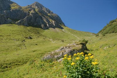
E5 Alpin Variante | Krahberg - Gogles Alm - Piller
Place: Zams | Fließ | PillerFrom the mountain station of the Venet cable car on the Krahberg, the tour leads along the Venet circular hiking trail via the Gogles Alm 2.017 m and the Galflun Alm 1.961 m to Piller.
Read more
Zams - Zammer Alm / Schihütte Zams via Wiesensteig
Place: ZamsFrom Zams, you hike along this section of the E5 European long-distance hiking trail through forest and flower meadows, partly along the ski piste, to the Zammer Alm and the Schihütte Zams.
Read more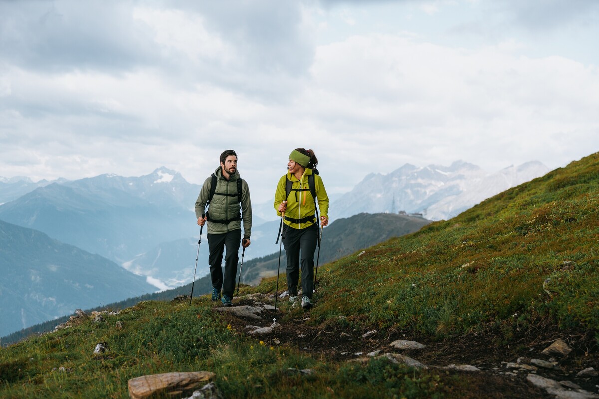
Krahberg - Glanderspitze
Place: Zams | FließThis hike leads from the mountain station of the Venetbahn cable car on the Krahberg 2,208 m to the Glanderspitze 2,505 m. The return journey follows the same route.
Read more
Zammer Alm / Schihütte Zams - Bettlersteig - Meranz Alm
Place: ZamsThis hike leads from the Zammer Alm / Zams ski hut via the Bettlersteig to the Meranz Alm. Return via the Lärchensteig to Tobi's adventure trail, which you then follow back down to the Zammer Alm.
Read more
Weg der Aussicht
Place: Zams | FließOn the popular "Weg der Aussicht", you can enjoy the circular path with its breathtaking view at the Venet mountain station.
Read more
Krahberg - Gogles Alm - Zammer Alm | 6a
Place: Zams | FließThis hike circles the Krahberg and leads via the Gogles Alm and the south side of the Krahberg to the mountain station of the Rifenal cable car.
Read more
Fließ - Bannholz - Gogles Alm
Place: FließThe hike leads from Fließ via the Venet Süd valley station up to the Gogles Alm and offers a magnificent view of the mountain world of the Kaunergrat Nature Park.
Read more
Kaunergrat Nature Park House - Glanderspitze
Place: FließA beautiful hike from the Nature Park House to the Gogles Alm 2,017m, which can be reached in 2 hours and 15 minutes. From the Gogles Alm, a path leads in 2 hours to the Glanderspitze 2,505 m with a magnificent panoramic view.
Read more
Landeck - Venetbahn Bergstation
Place: Landeck | ZamsStarting at the parish church in Landeck, the hiking trail number 3 leads you up to the Zammer Schihütte and Zammer Alm and from there up to the mountain station of the Venet cableway.
Read more
Krahberg - Glanderspitze - Gogles Alm
Place: Zams | FließThe circular hike leads from the cable car mountain station on the Krahberg 2,208 m to the Glanderspitze 2,505 m, from there down to the Gogles Alm 2,017 m and finally back to the mountain station of the Venet cable car.
Read more
Venetbahn Bergstation - Gogles Alm
Place: Zams | FließFollowing in the footsteps of the ‘Tiroler Edle’ pleasure route, the trail leads from the Krahberg over to the Gogles Alm.
Read more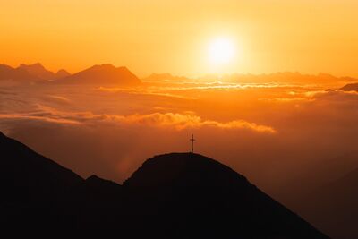
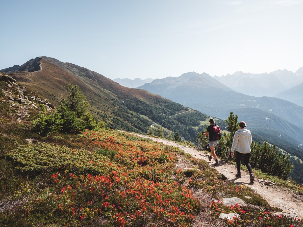
GenussWanderberg Venet
Place: ZamsThe local mountain Venet also offers a diverse nature experience in summer, which makes the hearts of all hiking fans and nature enthusiasts beat faster. The Venet hiking area serves as an ideal starting point for a variety of tours - from demanding high-altitude trails that challenge the stamina of even the most experienced hikers to leisurely strolls on easy forest and circular hiking trails.
Summer opening hours from 4 June to 27 September 2026
Facilities open in summer 2026
Rifenalbahn:
daily from 08:15 to 17:00
Weinbergbahn:
daily from 08:30 to 17:00
Rifenal ticket office:
daily from 08:00 to 17:00
The individual operating times of the lifts may be subject to change due to weather conditions and operational requirements.

Fließ - Bannholz - Spils - Jagerhütte
Beautiful hike from the centre of Fließ via Bannholz and Maranzgasse to the Jagerhütte.
Read more
Fließ - Bannholz - Spils - Jagerhütte
Beautiful hike from the centre of Fließ via Bannholz and Spils to the Jagerhütte.
Read more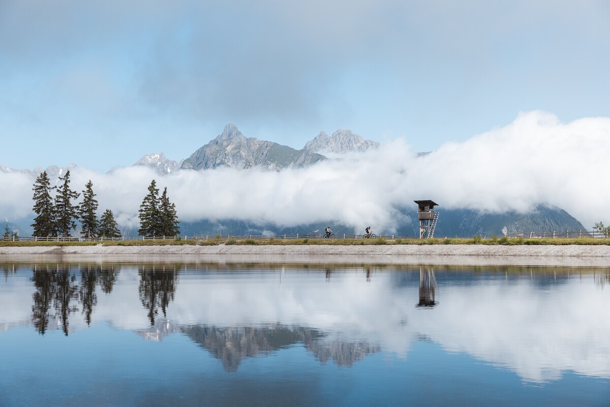
Venetbahn Bergstation - Zammer Alm
Place: ZamsHike from the Venetbahn mountain station via Tobi's adventure trail to the middle station.
Read more
Zams - Zammer Alm / Schihütte Zams via Wiesensteig
Place: ZamsAlong the European long-distance hiking trail E5, you hike from the valley station of the Venetbahn cable car through forests and flowering meadows, partly along the ski piste to the Zammer Alm / Zammer Schihütte and from there up to the mountain station of the Venetbahn cable car on the Krahberg.
Read more
Landeck - Zammer Alm / Schihütte Zams
Place: Landeck | ZamsFrom Landeck parish church, take hiking trail 3 up to the Schihütte Zams and Zammer Alm.
Read more
Naturparkhaus Kaunergrat - Venet-Rundwanderung
Place: Zams | Fließ | ImsterbergThe breathtaking view and the summit experience at the 2.512 m high Venet (Glanderspitze), as well as the culinary delights that you can enjoy in one of the rustic mountain pastures make this circular walk an unforgettable experience.
Read more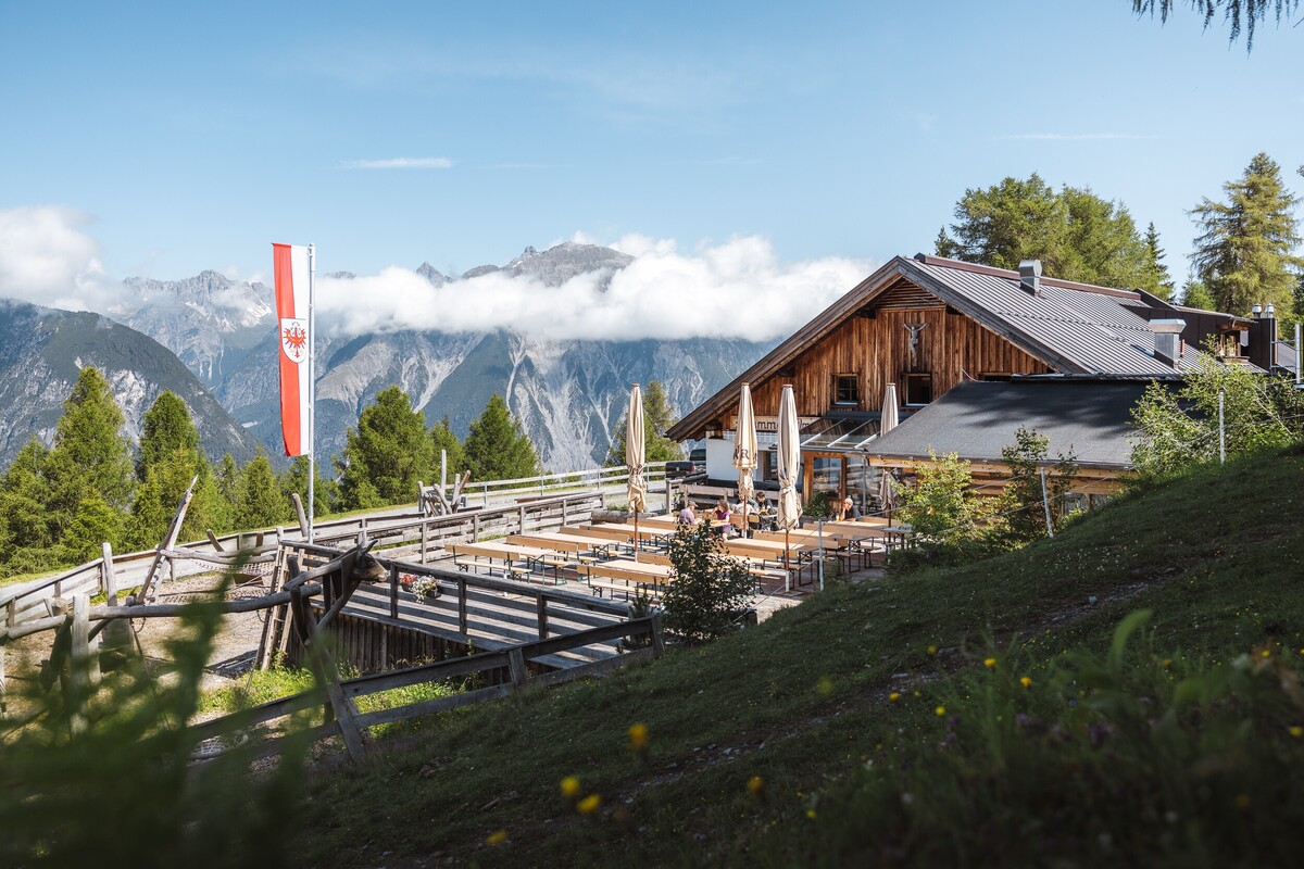
Meranz Alm - Bettlersteig - Zammer Alm
| Bild | Beschreibung |
|---|---|
 |
Free of charge with TirolWest Card |
Place: Zams
This hike leads from the Venetbahn mountain station via the Lärchensteig trail to the Meranz Alm. After a refreshment stop with fresh alpine produce, the route continues via the Bettlersteig to the Zammer Alm.
Read more
Fließ - Gogles Alm - Glanderspitze
Place: FließBeautiful hike from the car park above the turn-off towards Gogles Alm up to Gogles Alm 2,017m.
Read more
Krahberg - Gogles Alm - Krahberg
Place: FließLeisurely circular hike from the Krahberg to the Gogles Alm and back to the Krahberg via the Almsteig and the Schrotthütte.
Read more
Circular route: Piller – fishpond – Gogles Alm – Glanderspitze (summit cross) – Pillerkreuz (summit cross) – Galflun Alm
Read more
Gogles Alm - Glanderspitze
Place: FließFantastic hike from the Gogles Alm 2,017 m up to the Glanderspitze 2,505 m with a fantastic panoramic view.
Read more
Zams - Lahnbach - Krahberg
Place: ZamsThe first section of the hike leads from the Venetbahn valley station to Rifenal. From there, it continues up to Lahnbach and then on to the Zammer Alm and up to the Krahberg.
Read more