
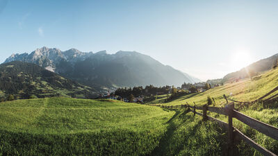
Kälbergatter - Wadlweiher - Piller Moor / 9
Place: FließBeautiful hike from the Kälbergatter junction via the forest pond to the Piller Moor and on to the Kaunergrat Nature Park House.
Read more
Zams - Zammer Alm / Schihütte Zams via Wiesensteig
Place: ZamsFrom Zams, you hike along this section of the E5 European long-distance hiking trail through forest and flower meadows, partly along the ski piste, to the Zammer Alm and the Schihütte Zams.
Read more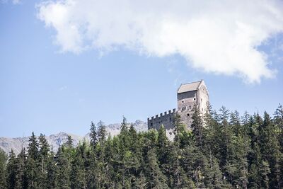
Zams - Kronburg
Place: ZamsStarting at the parish church in Zams you go through the Patscheid to Kronburg and via Rifenal, along the Jakobsweg, back to Zams.
Read more
Zams - Falterschein - Kronburg - Zams
Place: ZamsFrom the car park at the Venetbahn valley station, the circular trail leads via Anreit, Rifenal, Grist and Falterschein via Kronburg and the Zammer Patscheid back to the starting point.
Read more
Trams round
Place: Landeck | ZamsThis circular route leads along the former railway line - now an avenue of Japanese blood plums - to Anreit and soon joins a beautiful hiking trail to the Trams recreation area and the idyllic Trams pond. Well-maintained forest paths lead back to the starting point.
Read more
Jakobsweg Bahnhof Imst-Pitztal - Zams Zentrum
Place: Zams | Schönwies | ImstFrom Imst-Pitztal railway station, the Way of St. James leads via Obsaurs to the pilgrimage site of Kronburg in approx. 4:15 hours on a somewhat strenuous stage with a few climbs. From Kronburg, the Way of St. James then leads via Rifenal and Anreit down to the centre of Zams.
Read more
Zammer Alm / Schihütte Zams - Jagerhütte - Fließ
Leisurely hike from the Zammer Alm / Schihütte Zams over to the Jagerhütte and on to Fließ.
Read more
Pilgrimage Landeck - Kaltenbrunn
Place: Landeck | FließStarting from the parish church Maria Himmelfahrt in Landeck, the pilgrimage path leads via the historic Via Claudia Augusta to Fliess and on to the pilgrimage church Kaltenbrunn, in the Kaunertal.
Read more
Pilgrimage Kronburg - Kaltenbrunn
Place: Landeck | Zams | FließThe pilgrimage route leads from the pilgrimage church Kronburg on the historic Via Claudia Augusta to flow and on to the pilgrimage church Kaltenbrunn, in Kaunertal.
Read more
Forest Path Stanz - Grins
Place: Grains | StanzThe starting point of this beautiful tour is the plum village Stanz. Along meadows and orchards, you reach the Kneipp facility in Grins, which invites you to refresh yourself. On partially narrow forest trails the route leads youparkpl back to the village.
Read more
Waalweg Stanz - Grins
Place: Grins | StanzThis tour is called after an ancient irrigation system - the so-called "Waalen" - and runs on a gently undulating narrow path through the forest to above Grins and back over the forest path.
Read more
Fließ - Gogles Alm over Waldweiher
Place: FließConnecting path from Urgen up to Fließ to the Via Claudia Augusta and via Nesselgarten back to Urgen.
Read more
Zams - Kronburg - Patscheid
Place: ZamsFrom Zams, the trail leads via Anreit and Rifenal to the Kronburg pilgrimage church. The short ascent to the Kronburg ruins (approx. 25 minutes) offers a marvellous view of the surrounding mountains. The way back leads over the Zammer Patscheid.
Read more
Zirmegg - Perfuchser Schihütte
Place: Tobadill | LandeckFrom Tobadill a beautiful circular path leads you up to the Flatalm, on to Zirmegg and over the Perfuchser Schihütte and the DreiLalli-Weg back to Tobadill.
Read more
Schlosswald-trail Tobadill
Place: TobadillFrom Tobadill the path leads you down to Burgfried with wonderful views, then further though the forest to Wiesle and Badstube and back to your starting point.
ATTENTION:
Schlosswaldsteig between Burgfried and Plattils or Wiesle difficult to pass due to windthrow.
Gondawald-trail Tobadill
Place: Tobadill | PiansFrom Tobadill the path leads you down to Burgfried and through the Gondawald back up to Tobadill.
Read more
Flathalm - trail Tobadill
Place: TobadillBeautiful hike from Tobadill on the forest road up to Flathalm.
Read more
Flathalm - Giggler Alm
Place: TobadillNice hike from Tobadilll to Flatalm and over the Giggler Alm back to Tobadill.
Read more
Talkessel-Trail Tramser Weiher
Place: Landeck | ZamsA leisurely round from the parish church of Landeck via the trams to Zams and the Sonnenweg around the valley basin with wonderful impressions and views.
Read more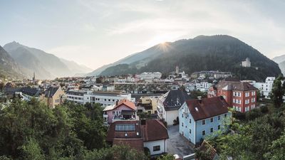
Talkessel-trail Landeck
Place: Landeck | ZamsTour around the valley basin of Landeck and Zams with wonderful impressions and views.
Read more
Stanz - Schrofenstein ruins
Place: StanzFrom Stanz, the trail leads eastward, slightly ascending and without a major change in direction, to the end of the forest road, from where you have a magnificent view of the Schrofenstein ruins.
Read more
Stanz - Grins
Place: Grins | StanzThe starting point of this wonderful walk is the Zwetschkendorf village of Stanz. Along meadows and orchards, you reach the Kneipp facility and continue to the healing water fountain in the centre of Grins.
Read more
Sonnenweg Bruggen-Perjen
Place: LandeckComfortable path in a wonderful sunny location above Landeck.
Read more
Schlosswald-trail Tobadill
Place: TobadillFrom Tobadill the path leads you down to Burgfried with wonderful views, then further though the forest to Wiesle and Badstube and back to your starting point.
Read more
Fließ - Gogles Alm - Glanderspitze
Place: FließBeautiful hike from the car park above the turn-off towards Gogles Alm up to Gogles Alm 2,017m.
Read more
Piller Moor circular walk
Place: FließLeisurely hike in a varied landscape and on footbridges through the moor. Archaeological sites on the site of the burnt offering and exciting information on the theme boards in the Piller Moor. Recommended even in rainy weather; Familyfriendly
Read more
Pfarrer Maaß circular trail
Place: FließStarting at the Barbara church, the Pfaarer Maaß path leads around Fließ up to the parish church. With its various stations, the path invites you to relax.
Read more
Piller Moor
Place: FließEasy walk in a varied landscape and on footbridges through the moor.
Read more
Harbe circular trail
Place: FließEasy circular hike to the Harbe Weiher and back to the nature park house.
Read more
Kaunergrat Nature Park House - Glanderspitze
Place: FließA beautiful hike from the Nature Park House to the Gogles Alm 2,017m, which can be reached in 2 hours and 15 minutes. From the Gogles Alm, a path leads in 2 hours to the Glanderspitze 2,505 m with a magnificent panoramic view.
Read more
Naturparkhaus Kaunergrat - Aifner Alm - Hoher Aifner
Place: Fließ | KaunerbergFrom the Nature Park House, it is a leisurely 2-hour hike to the Aifner Alm (1,980 m). The hike from the Aifner Alm to the Hoher Aifner (2,780 m) is more challenging and takes around 3 hours.
Read more
Meranz Alm - Bettlersteig - Zammer Alm
| Bild | Beschreibung |
|---|---|
 |
Free of charge with TirolWest Card |
Place: Zams
This hike leads from the Venetbahn mountain station via the Lärchensteig trail to the Meranz Alm. After a refreshment stop with fresh alpine produce, the route continues via the Bettlersteig to the Zammer Alm.
Read more
Landeck - Zammer Alm / Schihütte Zams
Place: Landeck | ZamsFrom Landeck parish church, take hiking trail 3 up to the Schihütte Zams and Zammer Alm.
Read more
Landeck - Venetbahn Bergstation
Place: Landeck | ZamsStarting at the parish church in Landeck, the hiking trail number 3 leads you up to the Zammer Schihütte and Zammer Alm and from there up to the mountain station of the Venet cableway.
Read more
Tramstrail Landeck
Place: Landeck | ZamsFootpath from the parish church in Landeck over the Kuckuckswald up to the local recreation area Trams and back down to the parish church.
Read more
Landeck - Kronburg
Place: Landeck | ZamsOn forest roads, forest and meadow paths from the parish church to the Kronburg pilgrimage site. The way back leads via the Patscheid meadows to Zams and back to the starting point.
Read more
Landeck - Fließ | Via Claudia Augusta
Place: Landeck | FließA hike from Landeck Castle along the historic Via Claudia Augusta to Fließ. Return either on foot along the same route or by public bus.
Read more
Landeck - Flathalm - Zirmegg
Place: Landeck | TobadillThis hike leads from Landeck via Perfuchs and the Drei-Lalli-Weg, a Waalweg, to Flathalm. From there it goes up to Zirmegg with the Zirmegg chapel. From there, the trail leads down to the Perfuchser ski hut and back down into the valley.
Read more
Krahberg - Gogles Alm - Zammer Alm | 6a
Place: Zams | FließThis hike circles the Krahberg and leads via the Gogles Alm and the south side of the Krahberg to the mountain station of the Rifenal cable car.
Read more
Krahberg - Gogles Alm - Krahberg
Place: FließLeisurely circular hike from the Krahberg to the Gogles Alm and back to the Krahberg via the Almsteig and the Schrotthütte.
Read more
Kälbergatter - Gachenblick
Place: FließBeautiful hike from the Kälbergatter junction up to the Kaunergrat Nature Park House at Gachenblick.
Read more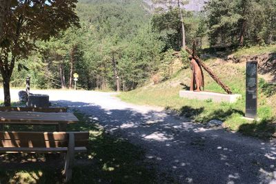
High Trail Stanzerwaal
Place: Stanz | GrinsNamed after an old irrigation system - the Waalen - the circular trail leads along a narrow, slightly hilly path through the forest to the well-known sulphur spring located just above Grins.
Read more
Hochgallmigg - Thialkopf
Place: FließFrom Hochgallmigg through the Urgtal valley up to the Thialkopf. The trail leads back down to Hochgallmigg via the Grametsee lake.
Read more
Hochgallmigg - Landecker Schihütte - Thialkopf
Place: FließBeautiful hike from Hochgallmigg to the Landecker ski hut and from there on to the Thialkopf.
Read more
Grins - Stanz- Schrofenstein ruins
Place: Grins | StanzEnjoyment and culture take centre stage on this circular hike on the sun terrace above the Landeck valley basin. The route leads from the picturesque mountain village of Grins through the forest, past the sculpture of the cross-bearer to just before the ruins of Schrofenstein Castle. You return through the centre of the Zwetschkendorf Stanz with the birthplace of the baroque master builder Jakob Prandtauer and along the meadows to the starting point.
Read more
Luftalb-trail Grins
Place: GrinsA myth tells of the 4 elements - fire, water, earth and air - which are embodied by the 4 Albigen (natural elves) and their influence on the forces of nature. Paths around the idyllic village of Grins were dedicated to the 4 Albigen.
Read more
Feueralb - trail Grins
Place: GrinsA myth tells of the 4 elements - fire, water, earth and air - which are embodied by the 4 Albigen (nature elves) and their influence on the forces of nature. Paths around the idyllic village of Grins were dedicated to the 4 Albigen.
Read more
Grins - Augsburger Hütte - Parseierspitze
Place: GrinsThe hut stands on a rocky outcrop from which you can enjoy a magnificent view. It is also the base of the Lechtaler Höhenweg and the starting point for the Parseierspitze, the highest peak in the Lechtal Alps.
Read more
Gogles Alm - Glanderspitze
Place: FließFantastic hike from the Gogles Alm 2,017 m up to the Glanderspitze 2,505 m with a fantastic panoramic view.
Read more
Fließ - Waldweiher - Gogles Alm - Glanderspitze
Place: FließWonderful hike from the nature park community of Fliess via the forest pond and the Gogles Alm 2,017m to the Glanderspitze 2,505m.
Read more
Fließ - Kaunergrat Nature Park House
Place: FließFrom Fliess via Schloss Siedlung up to the Kaunergrat Nature Park House, where a magnificent view of the surrounding mountains and the Kaunergrat Nature Park awaits.
Read more
Fließ - Egg - Gamplesplatte - Zammer Alm / Schihütte Zams | 4
Place: Zams | FließHike from Fliess via Schatzen and Egg to the Gamplesplatte. From there, continue in the direction of Larchegg and the middle station of the Venetbahn to the Zammer Alm / Schihütte Zams.
Read more
Fließ - Bannholz - Gogles Alm
Place: FließThe hike leads from Fließ via the Venet Süd valley station up to the Gogles Alm and offers a magnificent view of the mountain world of the Kaunergrat Nature Park.
Read more
Albigen Runde kompakt
Place: GrinsA myth tells of the 4 elements - fire, water, earth and air - which are embodied by the 4 Albigen (nature elves) and their influence name on the forces of nature. Paths and trails around the idyllic village of Grins have been dedicated to the 4 Albigen.
Read more
Wasseralb - trail in Grins
Place: GrinsA myth tells of the 4 elements fire, water, air and earth, which are represented by the 4 Albigen (nature elves), as well as their influence on the forces of nature.
Read more
Panorama-Talrunde
Place: Landeck | ZamsThe panoramic valley tour impresses with its views across the entire valley amidst the mighty surrounding mountain massifs. Well-maintained forest paths and marvellous views are the reward for the numerous ascents.
Read more
Venet circular hiking trail
Place: Zams | Fließ | ImsterbergThe breathtaking views and the summit experience on the 2,512 metre-high Glanderspitze, as well as the culinary delights when stopping off at one of the rustic mountain huts (Imsterberger Venetalm, Larcher Alm and Gogles Alm) make this circular hike an unforgettable experience.
Read more
Zams - Württemberger Haus | 631
Place: ZamsThe path leads steeply up to the Burschlbödele, above the climbing area Burschlwand, and then leads along the long-distance trail E5 to the Jagerhütte. There, the path branches off and leads up to the Württemberger Haus.
The Württemberger Haus is closed in summer 2025 due to renovation work. No overnight accommodation possible!

Zams - Steinseehütte - Württemberger Haus - Zams
Place: ZamsThis three-day tour leads from Zams into the mysterious world of the barren Lechtal Alps. You immerse yourself in wonderful mountain solitude and spend the night in two cosy Alpine Club mountain huts. Back to Zams, you hike through the Zammer Loch, one of the most beautiful mountain valleys in Europe.
Read more
Erdalb - trail Grins
Place: GrinsA myth tells of the 4 elements - fire, water, earth and air - which are embodied by the 4 Albigen (nature elves) and their influence on the forces of nature. Paths around the idyllic village of Grins were dedicated to the 4 Albigen.
Read more
Hinterfeldrunde Zams
Place: ZamsThis easy hike leads from the parish church of St Andrew in Zams through the Zammer Hinterfelder to the pedestrian bridge and then back to the starting point via Bachgasse.
Read more
Naturparkhaus Kaunergrat - Venet-Rundwanderung
Place: Zams | Fließ | ImsterbergThe breathtaking view and the summit experience at the 2.512 m high Venet (Glanderspitze), as well as the culinary delights that you can enjoy in one of the rustic mountain pastures make this circular walk an unforgettable experience.
Read more
Tobadill - Vorgiggl - Platils
Place: TobadillLeisurely hike from Tobadill to Wiesberg Castle, on to Platils and back to Tobadill.
Read more
Alfutzalm - Steinseehütte - Steinsee
Place: ZamsA beautiful hiking trail leads from the Alfutzalm to the Steinseehütte. From the Steinseehütte it is then about 45 minutes up to the Steinsee.
Read more
Burgenweg Landeck - Fließ - Landeck
Place: Landeck | FließThis path leads you from Landeck Castle to Biedenegg Castle in Fließ and back.
Read more
Dorfrundgang Zams
Place: ZamsThis leisurely hike leads from the Venetbahn car park through the Zammer Hinterfelder to the convent of the Sisters of Mercy and through the avenue back to the starting point.
Read more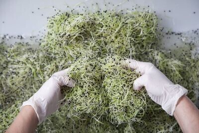
Enjoyment round spring seedlings
Crisp sprout shoots - Delicate green shoots that sprout from individual seeds are known as sprouts. These young shoots contain everything they need to grow into strong stalks, grains, or vegetables.
Read more
Zammer Alm / Schihütte Zams - Bettlersteig - Meranz Alm
Place: ZamsThis hike leads from the Zammer Alm / Zams ski hut via the Bettlersteig to the Meranz Alm. Return via the Lärchensteig to Tobi's adventure trail, which you then follow back down to the Zammer Alm.
Read more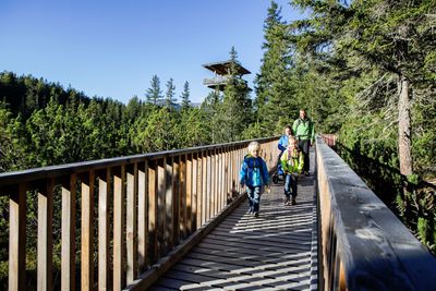
Piller Moor barrier-free
Read more
Meranz Alm (1.915m)
Open! Place: ZamsThe Meranz Alm (1,915 m) can be reached from the Venetbahn mountain station via the Lärchensteig in approx. 1 hour. It can be reached from the Rifenalbahn mountain station or from the Zammer Alm / Zams ski hut via the Bettlersteig in approx. 1.5 hours.
Read more
Venetbahn Bergstation - Zammer Alm
Place: ZamsHike from the Venetbahn mountain station via Tobi's adventure trail to the middle station.
Read more