At a Glance | |
|---|---|
| Difficulty level: | medium difficulty |
| Elevation loss: | 1630 m |
| Walking time / ascent: | 6.5 h |
Information | |
|---|---|
| Walking time / descent: | 4.75 h |
| Starting point: | Landeck Parish Church |
| Finishing point: | Landeck Parish Church |
| Path surface: | Asphalt, Forstweg, Steig |
Route type | |
|---|---|
| Circular hike: | Yes |
Fitness & technique | |
|---|---|
| Fitness: | 5 |
| Technical: | 4 |
Getting there | |
|---|---|
| Getting there: |
We recommend using the Landeck multi-day parking lot at Innstraße 44. From the multi-day parking lot, it takes about 15–20 minutes to walk to Landeck City Church. Alternatively, you can take bus line 2 from downtown Landeck to the church. Please check the SCHEDULE. |
| Public transport: |
From the Landeck-Zams train station, take any VVT bus to the city center. From there, it’s about a 15–20-minute walk to the church, or you can take bus line 2 (Kirche stop). Check the SCHEDULE. |
| Parking: |
Landeck Long-Term parking lot at 44 Innstraße |
Best season | |
|---|---|
| Jun: | Yes |
| Jul: | Yes |
| Aug: | Yes |
| Sep: | Yes |
| Oct: | Yes |


Recommendable for Landeck - Thialkopf - Hochgallmigg
In areas ofchurch - chapell, Mountain hut, Trinkwasserbrunnen

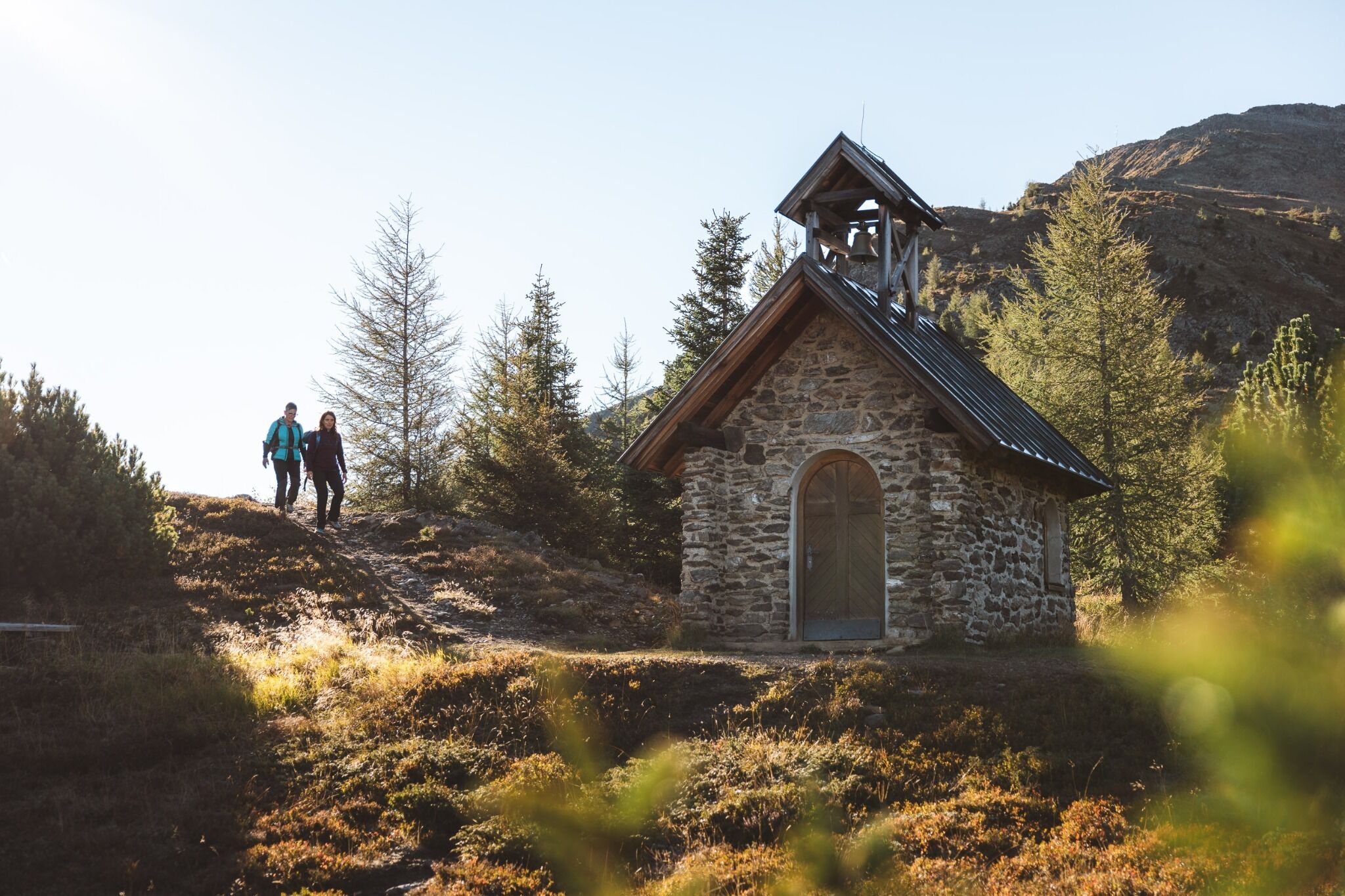
church - chapell: Zirmegg Chapel
The Zirmegg Chapel is located on the trail to Thialkopf (trail no. 18 or 20,19). From there there is a magnificent view of the basin of Landeck / Zams and in good visibility you can even see the Zugspitze.
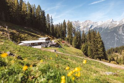
Mountain hut: Flathalm 1 687m
The Flathalm is at 1.687m above sea level and can be reached from Tobadill via a forest path. The Alm is managed in summer and invites you to rest.

Trinkwasserbrunnen: Trinkwasserbrunnen Landeck Perfuchser Schihütte
Drinking water at the Perfuchser Schihütte
Trinkwasserbrunnen: Florianibrunnen Fließ Hochgallmigg
Drinking water fontaine at Hochgallmigg.