Circular route: Piller – fishpond – Gogles Alm – Glanderspitze (summit cross) – Pillerkreuz (summit cross) – Galflun Alm

Wandern am Venet

Circular route: Piller – fishpond – Gogles Alm – Glanderspitze (summit cross) – Pillerkreuz (summit cross) – Galflun Alm

From the starting point you walk in the direction of Oberpiller passing the Piller fishpond. After walking on the Rodelbahn [toboggan run in the winter] for a short while you will reach a steep path in the direction of the catered mountain hut Gogles Alm. At the next fork, turn off right until the steep path joins up with a forest track. Follow this track to get to the Gogles Alm. Enjoy the vista from this mountain and after the Gogles Alm, continue to walk, bearing left on a steep path to the summit cross of  Glanderspitze. After this, walk along the ridge keeping right towards the Pillerkreuz (summit cross). To descend, retrace your steps for a few meters and then turn off left back to the Galflun Alm and then take a right towards Piller. This steep path forks off again to the right and then joins a path that takes you straight back to Piller.
Read more

At a Glance

Difficulty level:medium difficulty / red mountain path
Elevation loss:1200 m

Information

Starting point:Car park Piller Zentrum
Finishing point:Car park Piller Zentrum
Path surface:forest path, track

Route type

Circular hike:Yes

Getting there

Getting there:Take the bus till the bus stop Piller Oberpiller. For the arrival by car use the car park Piller Zentrum.

Altitude Profile

GPS Track

Download

Route by

Google Maps

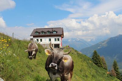
Recommendable for Circular route: Piller – fishpond – Gogles Alm – Glanderspitze (summit cross) – Pillerkreuz (summit cross) – Galflun Alm

In areas ofRestaurant, Mountain hut, Stop

Jausenstation Fischteich Piller  1 400 m

Restaurant: Jausenstation Fischteich Piller 1 400 m

Gogles Alm  2 017 m

Mountain hut: Gogles Alm 2 017 m

Galflun Alm  1 961 m

: Galflun Alm 1 961 m

Piller Oberpiller

Stop: Piller Oberpiller

Online Booking / Request